HOW BIG IS TEXAS?
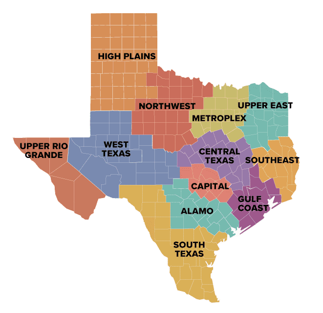
The Texas Comptroller’s office divides the state’s 268,000 square miles into 12 economic regions, each with at least one Census-defined metropolitan statistical area (MSA), urban areas with relatively high populations and close economic integration.
Texas’ population rose by about 16 percent between 2010 and 2020, compared to a 7.4 percent increase nationwide. Population growth was strongest in the Capital region (31.5 percent), followed by the Gulf Coast (19.9 percent), Metroplex (19.5 percent), and Alamo (17.5 percent) regions
Texas added more than 1.9 million jobs between 2010 and 2015, an increase of 17.1 percent, more than double the national growth rate. Energy-related industries are highly concentrated in Texas, as measured by location quotient (LQ). An LQ of 1.25 or higher indicates that the industry enjoys a competitive advantage in the region compared to other areas.
Source: Texas Comptrollers Office Statewide Report, 2022